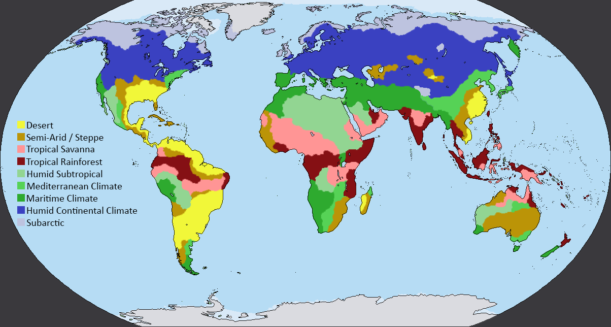
Climate
ATMOSPHERE I COMPONENTS OF ATMOSPHERE I COMPONENTS OF CLIMATE I FACTORS INFLUENCING LOCAL CLIMATE PATTERNS IN CLIMATE CHANGE I CLIMATIC DIVISIONS OF INDIA
Atmosphere
The atmosphere is a mixture of gases enveloping the Earth’s surface up to a height of around 300 kms. Nitrogen, oxygen and carbon dioxide gases are the major components of this mixture. The atmosphere has weight and exerts pressure.
Weather is the state of the atmosphere as experienced in a single location on the surface of the Earth. It is the product of the meteorological processes acting at any point of time including variables such as temperature, rainfall, wind and solar radiation.
Components of Atmosphere
The atmosphere is divided into various layers. These layers are as follows:
Troposphere
Nearest to the Earth’s surface, the troposphere is full of weather activities such as general atmospheric circulation and air turbulence. Its height above the Earth’s surface varies from 18 kms at the equator to 8 kms at the poles.
Stratosphere
The ozone layer present in the lower layer of the stratosphere contains high concentration of ozone (O3). This layer protects life on earth by absorbing 97-99 percent of the sun’s high frequency potentially harmful ultraviolet radiations.
Mesosphere
The mesosphere extends upwards from about 50 km above the Earth’s surface to a distance of 100 km though the upper and lower boundaries vary with season and latitude. The upper limit of the mesosphere is called mesopause. Temperature decreases with increasing altitude in the mesosphere. It falls to around -1000C in the upper reaches of the mesosphere.
Thermosphere
Important and interesting meteorological events that occur in this layer are airglow, Aurora Australis and Aurora Borealis, including self luminous gases glowing in the atmosphere.
Climate is the collective state of the atmosphere at a given place over a long period of time comprising average as well as extreme weather events. Generally 30 year average values are considered in order to know the climatic pattern of a given place. Climate is therefore a sum of the weather experienced at a place in the course of a year and also over many years.
Microclimate refers to the climate closer to the Earth’s surface in geographically defined sites and in villages, cities and towns. The microclimate of a place is affected by local factors such as variations in topography, the presence and density of vegetation, the presence of large water bodies and the nature of built development.
Components of Climate
Atmospheric Temperature
Atmospheric temperature is the temperature of the Earth’s atmosphere. It varies with latitude and altitude. Physiographic factors such as steepness and exposure of slope, orientation of topographical features and presence of extensive vegetation masses and large water surfaces also have an effect on air closer to the Earth’s surface.
Plant growth and plant animal metabolism in general are directly related to the atmospheric temperature regime prevailing at any place on the Earth’s surface.
Solar Radiation
Solar radiation directly affects the basic physiological processes of plants. Sunlight is vital to photosynthesis, germination, flowering and growth.
Mountain and Valley Breeze
During the day, sunlight first reaches the upper elevations of the mountains before it reaches the valley floor. The air high up in the atmosphere is heated up by the mountain surface sooner than that in the valley floor. As the warmer air expands, a low pressure zone is created near the top of the mountain. This attracts the air from the valley, creating a valley breeze that blows from the valley floor upwards on the valley slopes, towards the upper elevations of the mountain, in the night,conditions of pressure are reversed and cold air from the mountain top flows down the slopes to the warmer valley below, as mountain breeze.
Land and Sea Breeze
The movement of wind between land and water is a result of difference in air pressure over the land the ocean.as the temperature of the land surface cools down, the warm air, being less dense rises and creates a small of high pressure above the land surface. The net movement of winds in these conditions is from the shore to the water, as air above the sea surface is cooler and denser. This is known as land breeze. Sea breeze blows from the sea to the land, when the conditions of air pressure are reversed.
The Quantum of incoming radiation from the sun that reaches the surface of the Earth depends on the solar constant as well as the transparency of the atmosphere, it varies with latitude and seasons, day length and the angle of the sun’s rays relative to a particular geographic location.
Precipitation and Rainfall
Precipitation includes all the moisture that falls to the Earth in the form of snow, hail, rain and dew. Precipitation affects atmospheric humidity. As a virtual component of the hydrological cycle, it is the main source for ground water recharge and soil moisture, affecting surface and subsurface water regimes.
Wind System
The wind system is generated by the atmospheric pressure gradient; winds blow from zones of higher atmospheric pressure to those of lower atmospheric pressure. On a global scale, the general direction of movement is from the poles to the equator.
The wind system transports heat and moisture to the atmosphere. The direction of prevailing winds and their velocity in different seasons is of great significance in planning for human settlements and farm-land. Places inhabited by people or animals as well as areas cultivated for agricultural or horticultural crops need to be protected from extremes of wind velocity and also temperature. Wind velocity is affected by the topographical features, vegetation masses and geographical situations, such as mountain valleys, seas shores, river flood plains and deserts. Winds play a significant role in the creation of land form in arid regions and are responsible for soil erosion in coastal areas and desert lands.
Tropical Savanna Climate (Summer Dry)
A long stretch of land situated on the south eastern coast, east of the Western Ghats and the Cardamom Hills, receives least rainfall due to the rain shadow region. This region is a famine prone zone with very unreliable rainfall which varies between 400 mm to 750 mm annually. The coldest month is December with the temperature between 200C and 240C. the months of March to May are hot and dry with mean monthly temperatures above 320C.
Tropical Rainforest Climate
The lower southwest coastal region of the country enjoys this climate. A tropical rainy climate governs regions experiencing persistent warm or high temperatures, which normally do not fall below 180C. The average temperature in this belt ranges between 180C to 300C. India hosts two climatic subtypes that fall under this group. The most humid is the tropical wetland that covers a strip of south western lowlands abutting the Malabar Coast, the Western Ghats and Southern Assam. India’s two island territories – Lakshadweep and the Andaman and Nicobar islands are also subject to this climate. Characterized by moderate to high year round temperatures, even in the foothills, its rainfall is seasonal but heavy – typically above 2000 mm. Most rainfall occurs between May and November, the moisture is enough to sustain lush forests and other vegetation for the rest of the mainly dry year.
Hot Desert Climate
Most of western Rajasthan falls under this climate type characterized by scanty rainfall. Cloud bursts are largely responsible for all the rainfall seen in this region which is less than 300 mm. These happen when the monsoon winds penetrate this region in the months of July, August and September. The rainfall is very erratic and a few regions might not see rainfall for a couple of years. The summer months of May and June are very hot with mean monthly temperatures ranging between 350C and higher and sometimes 500C. The region has a high evaporation rate of 3000 mm annually. During winters, the temperatures can drop below freezing point in some areas due to cold waves. There is a large diurnal range of about 140C during the summer which becomes higher by a few more degrees during winter.
Different places on the Earth experience different types of climate at different times. Climate at a particular place is influenced by various factors, which are as follows:
Distance from the sea
Coastal areas, in the close proximity of water are cooler and wetter than inland areas, in the close proximity of water and cooler and wetter than inland areas. Clouds form when the warm air from inland areas meets the cool air from the sea. In the summers, the inner areas of large land masses have high temperatures, as moisture from the sea evaporates before it reaches the centre of the land mass. Winds that blow from the sea often bring rain to the coast and dry weather to land areas.
The two well defined coasts in India, on the West From Gujarat to Kerala, and on the East from West Bengal to Tamilnadu have climates that are generally cooler with some local variations-and far more humid than the central areas of the Deccan plateau, the Northern highlands, plains and other arid regions.
Relief
As altitude increases, air becomes thinner and its capacity to absorb and retain heat also reduces. The temperature on higher elevations is lower than the temperature at sea level. In general, the reduction in average temperature at upper elevations is proportionate to their height above mean sea level. Of course this reduction is less marked at lower latitudes (closer to the equator) than in the northern latitudes, as say in the Himalayan range and its foothills and the Gangetic plain.
On a continental scale, the Himalayas restrict cold winds from Central Asia from entering the plains of the sub-continent and India experiences comparatively milder winters as compared to Central Asia.
Proximity to the Equator
The Earth’s orbit and its position relative to the sun ensure that the Equator receives the maximum sunlight. Proximity to the Equator affects the climate as temperatures here are the highest as compared to other places on the Earth’s surface.
Zones between the north and south latitudes of the Equator – the Tropic of Cancer and the Tropic of Capricorn respectively – are known to possess a tropical climate. The Tropic of Cancer passes through the middle of the country from Kutch in the west, through Madhya Pradesh in central India, to Mizoram in the east. About half of the country lies south of the tropic and possesses the characteristics of a tropical climate. North of this is the Subtropical Zone.
Climate and Landscape Architecture
A key factor that affects landscape design and development decisions, the climate of a region defines the basis for comfort design. Hot, cold, humid and dry conditions all demand interventions that will modify extreme conditions towards a level of comfort that is acceptable for the users of a site. Components of climate – ambient temperature, solar radiation, wind speed and precipitation when combined with the particular geomorphological aspects of a site and its surroundings create microclimatic situations within the site which need to be addressed to create more amenable conditions for use. For example, in colder climates, the warming effect of the sun in winter can be maximized through the use of deciduous vegetation and dark coloured hard surfaces, while walls and evergreen trees can be located to deflect cold winds from the north. In warmer climates, the same walls and trees in shelterbelts can be used to deflect hot winds away from buildings. Trees can be planted closer to the buildings to shade east and west walls which get maximum sunlight, while stone screens – jaalis and carefully located water bodies can mitigate adverse climate conditions.
In landscape design, seasonal variations affect the vegetation (form, foliage characteristics with colour of leaves and flowers). They also influence the natural phenomenon of flow of natural streams and rivers. They define the character of the landscape of a region in that particular time of the year. Climate also influences the amount of rainfall and the availability of groundwater, which has a direct bearing on the types of vegetation that grow with the least amounts of maintenance and supplemental water.
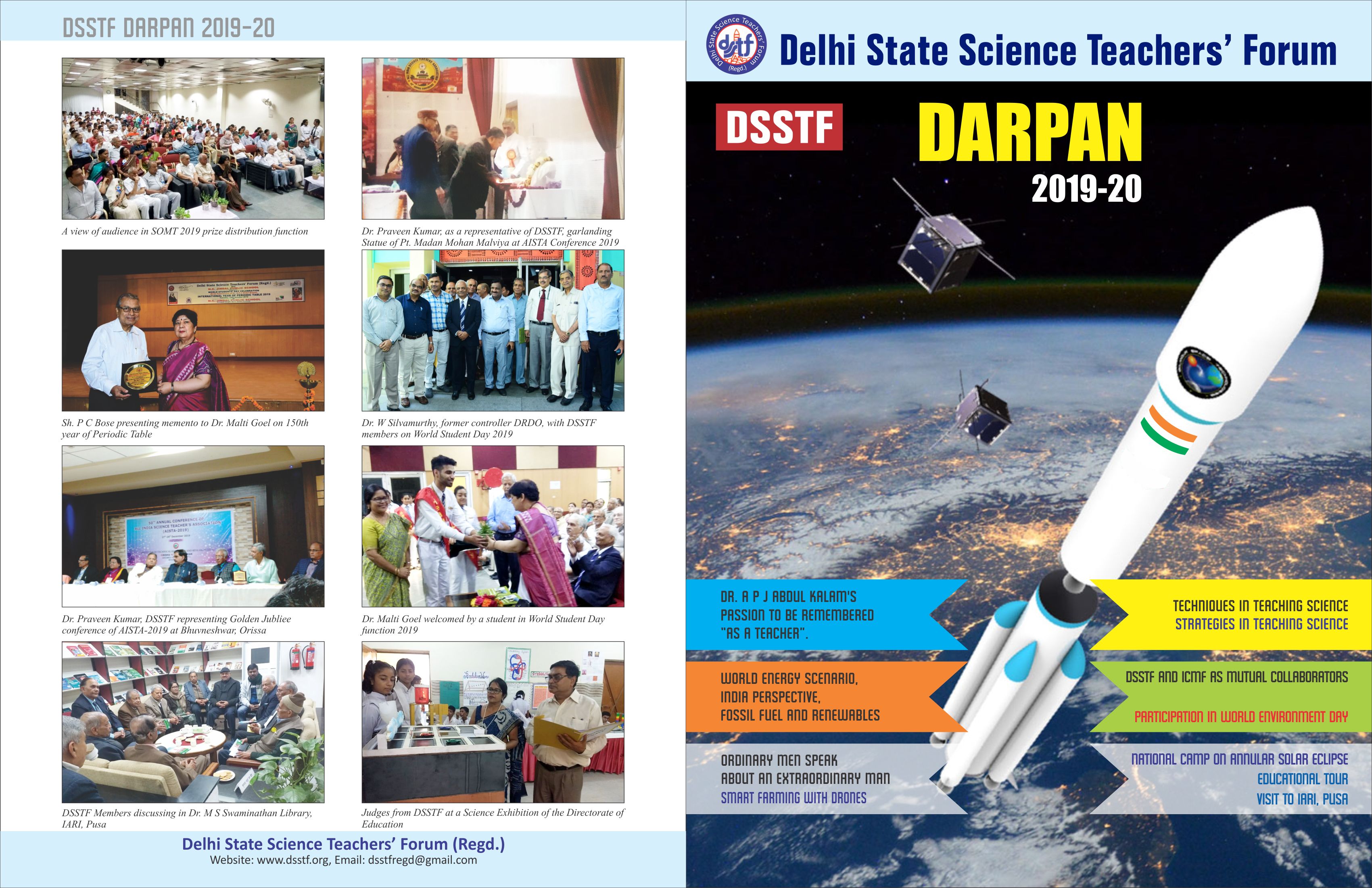
K K NATHAN
Principal Scientist (Retd.)
I C A R, New Delhi